Many terrestrial wild animals migrate – daily, seasonally or in the course of their entire lives. In today’s anthropised landscape, they therefore encounter obstacles such as roads, settlements, walls, fences, but also cleared areas where they can no longer find cover.
With the description of the large-scale connecting axes and wildlife corridors, the FOEN has created a basis that shows Switzerland’s connectivity system for habitats of terrestrial wildlife species. The connecting axes show established migration and dispersal routes that link habitats over a large area. Wildlife corridors are areas along the connecting axes that are permanently limited or impaired by natural or anthropogenic structures. Keeping these corridor areas open or enhancing them is crucial to enable wildlife to engage in genetic exchange, species-specific population and spatial dynamics (e.g. seasonal migration), and active dispersal. The precise description of wildlife corridors thus forms an important working basis for the cantonal administrations on the subject of connectivity and should ensure the permeability of the landscape for wildlife in the future, despite further construction activities.
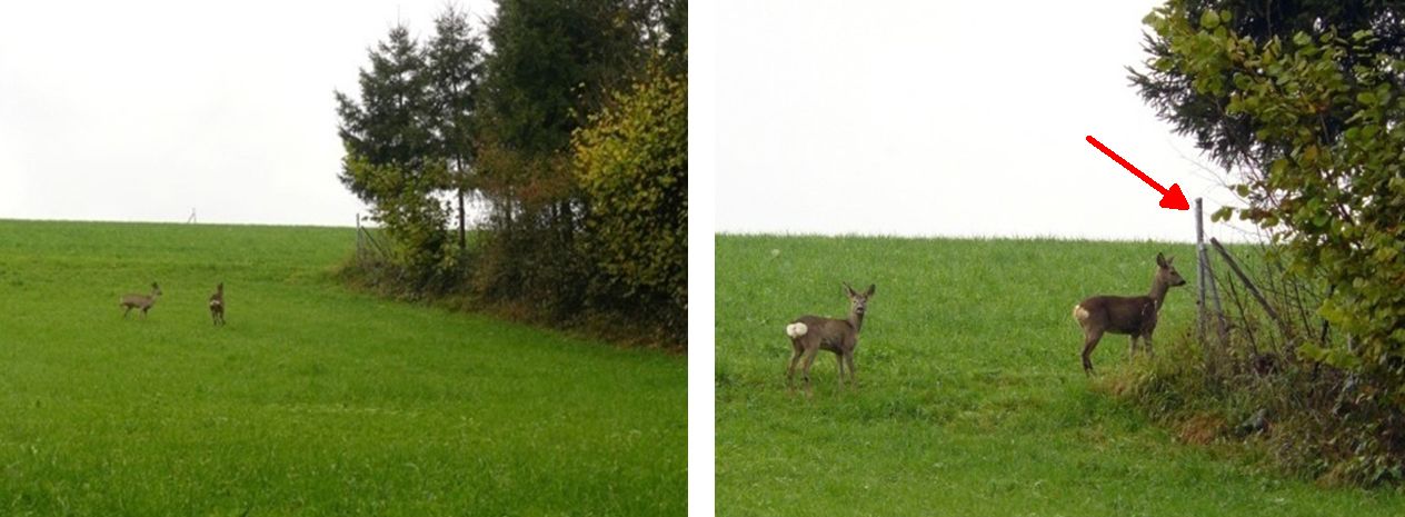
Anthropogenic barrier in a wildlife corridor: A doe with fawn tries to find cover in a stepping stone biotope. However, the supposed place of refuge turns out to be inaccessible because of a knot fence (arrow).
The present evaluation and update involved a reassessment of both the connecting axes and the wildlife corridors of the Canton of Zug. In a first step, the landscape of Canton Zug was analysed using GIS. The routes of the axes were updated and, where necessary, additional regional or local axes were identified. The perimeters of the wildlife corridors were also updated and additional corridor perimeters were defined. This was followed by an assessment of the identified corridors using GIS data and in the field, where important attributes such as routing structures, forced crossings and barriers were recorded. Each wildlife corridor was described in detail with an object sheet and possible measures for upgrading were identified.